

Climate factors in the Canary Islands
The main factors determining the climate of the
Canary Islands are as follows:
-The Azores
High. The Azores High prevails over the Canary Islands around 90
per cent of the time during the summer, and 50 per cent of the time during
the rest of the year. It produces very stable weather, with moderately warm
temperatures, no rainfall, overcast skies on the north-facing slopes due to
the sea of clouds effect, and clear skies on the south-facing slopes. Most
characteristically, it produces a type of wind known as the trade winds,
which blow across the Atlantic Ocean at a speed of around 20 km per hour
and, as they travel, take on the coolness and humidity of the sea. This is
why, when they reach the islands, they cool the air and moderate the
temperatures.
-North Atlantic storms.
During the winter, the Azores High weakens, allowing storms from the North
Atlantic to pass through, bringing cold and rainy weather.
-Tropical storms. These are caused by the arrival of storms
from the south and west. They are most common in winter, although in some
years none occur at all. Temperatures drop slightly and rainfall becomes
widespread, even on the southern slopes of the islands. On the highest
peaks, such as Mount Teide or Roque de los Muchachos, they can lead to heavy
snowfall.
-‘Tiempo sur’. The
phenomenon known in the Canary Islands as ‘tiempo sur’ originates from the
nearby Sahara Desert, which, particularly in summer and to a lesser extent
in winter and spring, brings dry, hot weather with abundant clouds of
suspended dust (calima), and sometimes strong winds.
-The
Canary Current. The temperatures of the waters surrounding our
archipelago are cooler than one would expect given their geographical
location, due to the presence of the so-called Canary Current, which
moderates temperatures and prevents hurricanes and tropical storms from
reaching the islands.
-The terrain.
In the Canary Islands, temperatures drop by around one degree Celsius for
every 100 metres of altitude gain, until they reach the thermal inversion
zone of the trade winds, at an altitude of around 1,500 metres. Furthermore,
when the lower, moisture-laden trade winds collide with the mountainous
areas on the north-facing side of the islands, they cool and condense,
forming what is known as a sea of clouds: a dense layer of clouds, flat on
top and laden with moisture.

The trade winds
The trade winds are winds that blow
over the archipelago almost constantly, although they are stronger during
the summer months and weaker and more intermittent in winter. Their most
distinctive feature is their arrangement in two superimposed layers: a
lower, humid layer blowing from the north-east, and an upper layer of dry,
warm air blowing from the north-west. When these layers interact, they
create a temperature inversion with variable boundaries, the most striking
consequence of which is the formation of what is known as a sea of clouds.
This phenomenon occurs when the air, upon colliding with the mountains, is
forced to rise and cools almost to the point of condensation, giving rise to
a dense cloud formation which, unable to develop upwards, spreads
horizontally, covering large areas of the northern slopes of the highest
islands.
In turn, the presence of the sea of clouds
gives rise to another phenomenon known as horizontal rain, which occurs when
moisture from the clouds condenses on the leaves of trees, forming water
droplets that eventually slide down the leaves and fall to the ground. And
it is precisely these climatic conditions that allow for the existence of a
type of forest that is almost non-existent in other parts of the world: the
laurel forest, a remnant of the great temperate forests of the Tertiary
Period that is found in only a handful of places on the planet.

Types of weather
The different types of weather experienced in the
Canary Islands depend primarily on the air masses affecting the archipelago
at any given time. The most common is the tropical maritime air mass, which,
due to its oceanic origin, has a high relative humidity. At its centre lies
the Azores High, whose most characteristic feature is the atmospheric
stability it creates and its resulting influence on the typical weather in
the Canary Islands, with mild temperatures in winter and cool temperatures
in summer, and moderate humidity throughout almost the whole year.
When temperatures drop and the sky becomes overcast with dark, rain-bearing
clouds, the archipelago comes under the influence of the polar maritime air
mass, originating from the North Atlantic, which generates significant
atmospheric instability, occasionally leading to heavy rain and snowfall, as
well as very low temperatures. Finally, when temperatures on the islands
rise and the air feels very dry, the Canary Islands are under the influence
of a tropical continental air mass originating from the Sahara Desert, which
generally brings with it a large amount of airborne dust known on our
islands as ‘calima’ or ‘calina’; when at its densest, this can reduce
visibility to just a few dozen metres.

Rainfall
In mid-altitude areas, rainfall can reach
800–1,000 mm per year on north-facing slopes, which are exposed to constant,
humid trade winds. It is in this sector that the sea of clouds stagnates,
bringing high levels of atmospheric humidity and a considerable volume of
water, making the area ideal for agriculture. In contrast, on the
south-facing slopes, rainfall is significantly reduced as the sea of clouds
dissipates.
In the high-altitude areas, mainly on the
highest islands, the trade winds cease to have an effect; rainfall averages
around 400 mm per year, well below the levels seen in the mid-altitude
regions, and in many cases falls as snow.
Rainfall in the Canary Islands is heaviest in late autumn and, above all, in winter, with summer being the driest season of the year. Rainfall is characterised by inter-annual variability; in other words, there is a succession of rainy or very rainy years, alternating with dry or very dry years. Rainfall is usually very localised, and on some occasions it poses a significant weather risk. When there is a sharp descent of air masses from the temperate zone, combined with tropical factors, very intense rainfall can occur within a very short space of time, causing torrential downpours comparable to those caused by the ‘cold drop’ phenomenon that occurs in late summer in the Mediterranean basin.

Temperatures
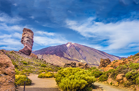
As far as temperatures are concerned, the archipelago is characterised by mild climatic conditions. Generally speaking, the warmest temperatures are recorded on the southern coasts of all the islands, where the annual average exceeds 20°C. On the islands of Lanzarote and Fuerteventura, which do not reach altitudes of 1,000 metres and are therefore below the level at which sea fog forms, this average temperature is found across almost their entire surface, making them the driest islands. On the other islands, as altitude increases, the average annual temperature drops to around 14°C on the peaks of Gran Canaria, to 13°C on those of El Hierro and La Gomera, to around 9°C in the highlands of La Palma, and to as low as 5°C in the Cañadas del Teide on Tenerife.


Canariavision
Visual Guide to the Canary Islands
Visualcuba
 Visual Guide to Cuba
Camaravision
 Digital Art Photography