

One of the best-known portraits of Alexander von Humboldt
Humboldt in Tenerife
The great explorer and
humanist Alexander von Humboldt was born in 1769 into a prominent and
wealthy Prussian family. Educated by the finest teachers in Berlin, he soon
abandoned his law studies to turn his attention to science, particularly the
fields of geology, physical geography, oceanography, meteorology, botany and
anthropology.
He carried out numerous experiments and
field studies across all these disciplines: he analysed the currents of the
Pacific; he introduced the use of isobars and isotherms in the creation of
climate maps; he conducted a study of the Earth’s geography; was the first
to establish a link between the drop in average temperature and increasing
altitude; discovered that the Earth’s magnetic field decreases from the
poles towards the equator; investigated volcanoes, demonstrating that their
formation depended on the formation of faults in the ground; and made many
other contributions.
Such was his intelligence,
capacity for work, discoveries, proposals for new theories and scientific
output that many consider him to be the last universal scientist, heir to
the great scholars of Antiquity and the Renaissance.

Commemorative stamp marking the 250th anniversary of the birth of Alexander von Humboldt
In 1797, he travelled to
Paris, where he met Aimé Bonpland, a young doctor and botanist with whom he
formed a close friendship and shared a desire to undertake a major
scientific expedition across Africa. However, after several failed attempts,
they decided to change continent and travel to Central and South America.
Thus, with the support of the Spanish authorities, and funded out of his own
pocket after inheriting a considerable fortune, on 5 June 1799 they set sail
from La Coruña aboard the corvette Pizarro, bound for Havana, carrying on
board numerous suitcases and several dozen of the most modern and expensive
scientific instruments of the time, such as Berthoud’s chronometer and
Ramsden’s sextant.
Humboldt asked the captain to
stop the ship in Tenerife for a few days upon reaching the Canary Islands
“…to visit the port of Orotava and climb to the summit of Mount Teide”, the
main reason he wished to visit the islands. Thus, on 19 June 1799, Humboldt
and his companion Bonpland arrived at the port of Santa Cruz de Tenerife.
They had six days to explore everything they had been dreaming of over the
past few months. They focused their trip on the northern part of the island,
visiting La Laguna, La Orotava and Puerto de la Cruz, observing and
recording extensive evidence of the island’s flora and fauna, as well as
making interesting notes on the indigenous population and Canarian society
at that time.

Portrait of Humboldt and his companion Bonpland at their camp in the Amazon
On the third day of their
stay in Tenerife, Humboldt, his companions and his guides set off from
Puerto de la Cruz to follow the so-called Camino de Chasna and climb to the
summit of Mount Teide, the main reason for their visit to the Canary
Islands. As a true naturalist, he took careful note of the vegetation he
encountered as he ascended the island’s highest mountain.
Humboldt was
struck by the number of species that were unlike anything he had ever seen
before, particularly among the high-mountain flora. The Teide daisy,
Argyranthemum tenerifae, the Teide violet, Viola cheiranthifolia, and the
imposing red tajinaste, Echium wildpretii, form part of a unique landscape
that left a lasting impression on the explorer’s notes and reflections.
The visual, emotional and
scientific impact that the sight of El Teide’s extraordinary flora had on
Humboldt is reflected in this excerpt from one of his writings. “We ran
about like mad from one place to another, unable to make clear observations
because, whenever we picked up a rare specimen, we would put it down as soon
as we saw an even more curious one beside it.” And this excitement on the
part of both scientists is hardly surprising, given that their visit to
Mount Teide coincided with the peak flowering season in that spectacular
part of Tenerife.
Although it seems the weather was
not particularly clear that day, in one of his texts he recalls that whilst
in “…the summit of Pico de Tenerife, where a horizontal layer of
dazzlingly white clouds separates the ash cone from the plateau below, and
where, suddenly, thanks to an updraft, the view finally stretches from the
very rim of the crater all the way to the vineyards of La Orotava, the
orange groves and the lush clusters of banana trees along the coast, pretty
little villages on the shore, the sea and all seven islands, amongst which
La Palma and Gran Canaria have very high volcanoes, which appeared below us,
as if on a geographical map".

The interior of the crater at the summit of Mount Teide, based on Humboldt’s description
As he climbed the volcanoes, Humboldt realised that
the distribution of the various plant species varied according to altitude.
He was the first to organise the plants, classifying them according to the
different vegetation zones based on the topography of the terrain,
microclimates, temperature differences and altitude levels; this description
of vegetation integrated into the natural environment is one of his great
contributions to modern science, and one which would lay the foundations for
what would later become geobotany and biogeography.
His observations were later set out in his Tableau physique des Iles
Canaries. Géographie des Plantes du Pic de Tenerife, one of the most
notable works in the history of Canarian botany. In this work, Humboldt
identified five vegetation zones on Tenerife, ranging from sea level to the
summit of El Teide, which he named the Vine Region, the Laurel Region, the
Pine Region, the Broom Region and the Grass Region.

Tableau physique des Iles Canaries. Géographie des Plantes du Pic de Tenerife
After visiting La Laguna,
Humboldt set off for Puerto de la Cruz, passing through the areas of
Tacoronte, La Matanza and La Victoria on his way. Upon catching sight of the
Orotava Valley, the explorer was struck by its beauty and stopped to take a
closer look.
It may well have been from that very spot
that he first caught sight of the famous thousand-year-old dragon tree in
the gardens of the Franchy mansion, in the town of La Orotava, which he
later had the opportunity to see up close. This dragon tree is the largest
on record in history; it is said to have stood 20 metres tall and measured
24 metres in circumference, and that up to a dozen people could gather
inside its gigantic hollow trunk, whether to have tea or to attend mass, as
it served as a chapel. Unfortunately, all that remains of this colossal tree
are a few engravings in which its imposing form can be seen, for after
suffering numerous instances of damage and broken branches due to the many
storms it endured throughout its long life, a tremendous storm finally
brought it down in 1867.

El famoso drago de Franchy, en La Orotava
Humboldt’s Vegetation Zones
“The island of Tenerife,
known as ‘Chinerfe’ by the Guanches, currently comprises five distinct plant
zones, which can be identified by the names: the Vine Region, the Laurel
Region, the Pine Region, the Broom Region and the Grass Region.
These
zones are arranged in tiers, one above the other, and cover a vertical
height of 1,750 toesas (3,400 m) on the steepest slope of Pico. If the
plants in Tenerife do not reach the summit of the volcano, it is not because
the perpetual snows and the cold atmosphere impose limits that they cannot
overcome; rather, it is the scoria-rich lava of the ‘malpaís’ and the arid,
crushed pumice of the Pilón that prevent the plants from spreading as far as
the crater’s rim.
The first area,
that of the vineyards, stretches from the coast up to an altitude of 200 or
300 toesas (381–584 m); it is the most densely populated and the only one
where the land is carefully cultivated. Among its plant species are eight
species of tree-like Euphorbias, Mesembryanthemum – which are found from the
Cape of Good Hope to the Peloponnese – Cacalia kleinnia, the dragon tree and
other plants which, with their bare, gnarled trunks and succulent,
bluish-green leaves, display the distinctive features of African vegetation.
In this area, date palms, bananas, sugar cane, Indian fig trees, Colocasia
esculenta (taro)—whose root provides the local people with a nutritious
starch—olive trees, European fruit trees, vines and cereals are cultivated.
Wheat is harvested from late March to early May, and successful trials have
been carried out with the cultivation of the Tahitian breadfruit tree, the
cinnamon tree from the Moluccas, the Arabian coffee tree and the American
cocoa tree. In several parts of the coast, the country exhibits all the
characteristics of a tropical landscape, and it is recognised that the
palm-tree region extends beyond the boundaries of the tropical zone.
The second area,
that of the laurels, comprises the wooded part of Tenerife: it is also the
region of the springs that bubble up amidst evergreen, damp grasslands.
Magnificent forests crown the hills flanking the volcano; four species of
laurel can be identified there, an oak related to Quercus turneri from the
mountains of Tibet, Visnea mocanera, Myrica faya from the Azores, a native
olive tree (Olea excelsa) which is the tallest tree in this area, two
species of Sideroxylon with foliage of rare beauty, Arbutus callycarpa and
other evergreen trees of the myrtle family. The trunks of the laurels are
covered with bellflowers and a type of ivy quite different from the European
variety (Hedera canariensis), and at their feet there is an innumerable
quantity of ferns, of which only three species—two Acrostichum and
Ophioglossum lusitanicum—extend down to the level of the vines. The ground,
covered everywhere with moss and fine grass, is dotted with the flowers of
Campanula aurea, Chrysanthemum pinnatifidum, Mentha canariensis and various
shrubby species of Hypericum (Hypericum canariense, Hypericum floribundum
and Hypericum glandusolum). Plantations of wild and transplanted chestnut
trees form a wide belt around the spring area, which is the greenest and
most pleasant of all the vegetated areas.
The third zone
begins at an altitude of 900 toesas (1,750 m), where the last clusters of
strawberry trees, Myrica faya and that beautiful heather which the locals
call ‘Tejo’ can be found. This zone, 400 toesas wide, is entirely covered by
a vast pine forest, interspersed with Broussonet’s Juniperus cedrus. These
pines have very long, rather stiff needles, sometimes arranged in pairs, but
more often in groups of three within a sheath. Having had no opportunity to
examine the cones, we do not know whether this species, which resembles the
Scots pine in appearance, is in fact distinct from the eighteen species of
pine already known in the Old World. We found the last pines on the slopes
of Mount Teide at an altitude of 1,200 toesas (2,335 m) above sea level. In
the mountain ranges of New Spain, below the equatorial zone, Mexican pines
grow up to 2,000 toesas. Owing to the similarity in structure that exists
between the different species of the same genus of plants, each requires a
certain temperature and composition of the ambient air for its development.
In temperate climates and wherever snow falls, the constant heat of the soil
is slightly higher than the average temperature of the atmosphere; it is
likely that, at the altitude of El Portillo, the roots of the pines draw
their nourishment from soil in which, at a certain depth, the temperature
rises to just 9 or 10 degrees.
The fourth and
fifth zones, regions of broom and grasses, lie at altitudes
rivalling those of the most inaccessible peaks in the Pyrenees. This is the
barren part of the island, where piles of pumice, obsidian and fractured
lava hinder vegetation growth. We have already mentioned those flower-filled
clusters of alpine broom (Spartium nubigenum) that form oases amidst a vast
sea of ash. Two herbaceous plants, Scrophularia glabrata and Viola
cheiranthifolia, venture further out into the barren landscape. On grass
scorched by the heat of an African sun, Cladonia paschalis covers arid
ground, and shepherds light fires there, which spread over considerable
distances. Towards the summit of the Peak, Urceolaria and other plants of
the lichen family work to break down the volcanic debris. In this way,
through the ceaseless action of organic forces, the realm of flora extends
across the islands transformed by volcanoes."

El mirador de Humboldt, en el valle de La Orotava
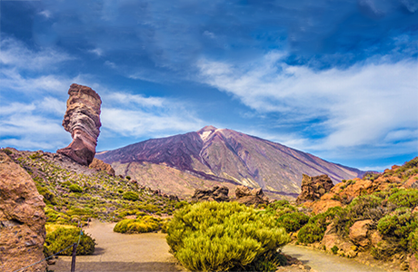
There is now a viewpoint named after Humboldt at the spot where he stopped to gaze upon the marvellous Orotava Valley, with the impressive peak of Mount Teide in the background; and, as the story goes, he fell to his knees at the sight nature had to offer, declaring it to be the most spectacular landscape he had ever seen. Whether it is truth or legend, the fact remains that from this spot, on sunny days when snow-capped El Teide stands out against the blue sky, we can imagine the feelings the great German scientist must have experienced throughout his stay in Tenerife, and transport ourselves to the unique landscapes depicted in his diaries.
"I came back from the peak yesterday – in the evening! What a sight! What a joy!… I’m leaving with tears in my eyes; I would have loved to settle here...", Humboldt wrote in his diary before leaving Tenerife.


Canariavision
Visual Guide to the Canary Islands
Visualcuba
 Visual Guide to Cuba
Camaravision
 Digital Art Photography